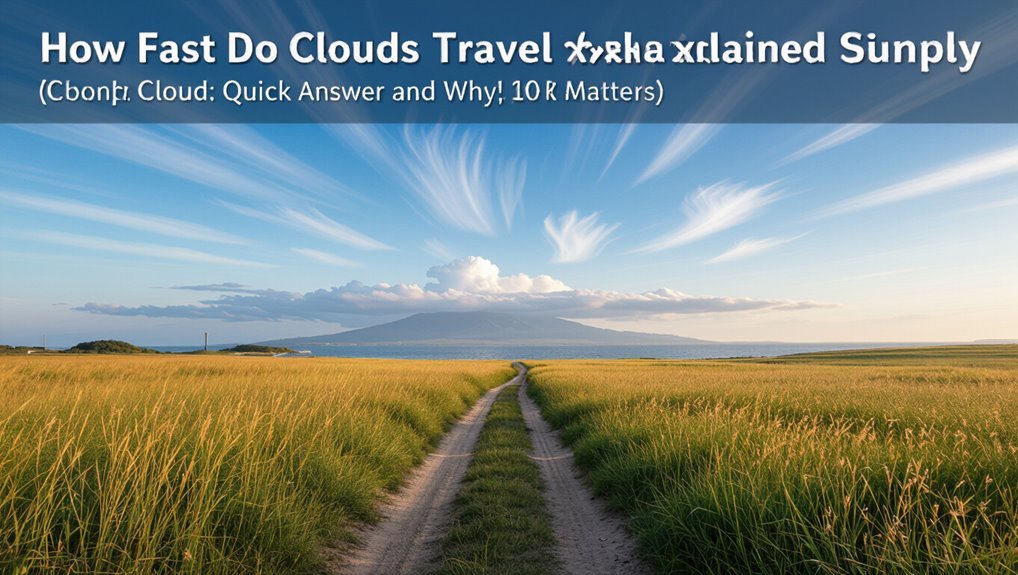
How Fast Do Clouds Travel Explained Simply
Cloud speed is just the wind carrying the cloud, so you’ll see high thin cirrus streak by fast while low stratus creeps along. Speeds vary with height, weather systems and local terrain—strong fronts and jet streams push clouds much faster than calm, stable air. You can estimate speed by timing clouds against landmarks or checking wind reports aloft. Watch layers move differently to spot shear, and keep going to learn how to estimate speeds and what they mean for plans.
Cloud Speed: Quick Answer and Why It Matters
How fast do clouds move, and why should you care?
You notice clouds shift because winds steer them, so their speed hints at weather changes and storm timing.
Faster clouds often signal stronger winds aloft and approaching fronts, affecting flights, sailing, and outdoor plans.
Faster clouds can mean stronger winds aloft and approaching fronts—impacting flights, sailing, and outdoor plans.
Watching their pace helps you anticipate rain, turbulence, or clearer skies, giving practical foresight.
What “Cloud Speed” Actually Means
When you hear “cloud speed,” it can mean the actual motion of cloud droplets across the sky or the wind speed at the altitude those clouds sit in.
You’ll want to separate wind-driven displacement from local cloud formation and dissipation, since clouds can appear to move differently than the air around them.
To understand this properly, you’ll look at methods for measuring cloud velocity—from tracking features in time-lapse images to using radar and wind-profile data.
What Cloud Speed Means
Cloud speed isn’t just how fast a visible cloud moves across the sky; it describes the horizontal velocity of the air mass carrying the cloud, relative to the ground.
You’ll interpret cloud speed as a vector: magnitude (how fast) and direction (where it’s headed). It’s measured at the cloud’s altitude and can vary with height, time, and local atmospheric conditions.
Wind Versus Cloud Movement
Although you often judge a cloud’s speed by watching its visible edges, what you’re really seeing is the wind’s motion at that altitude carrying the water droplets or ice crystals; the cloud itself doesn’t move independently of the air.
You should distinguish between wind profile and cloud appearance: shear, turbulence, and vertical motions reshape clouds even when transported, so apparent motion mixes translation with local evolution.
Measuring Cloud Velocity
Because what we call “cloud speed” really refers to the motion of the air carrying the droplets or ice crystals, you need to think regarding wind velocity across the cloud layer rather than a single object moving on its own.
To measure cloud velocity, you compare successive satellite or time-lapse images, track features, or use Doppler radar and wind profilers to get precise horizontal speeds.
How Altitude Changes Cloud Speed
When you look up, remember that altitude strongly affects how fast clouds move: winds generally increase with height, so high-altitude clouds like cirrus can race across the sky much faster than low fog or stratus layers.
- High clouds — faster, due to stronger winds.
- Mid-level clouds — moderate speeds.
- Low clouds — slower, tied to surface conditions.
- Vertical shear — different layers move at different rates.
How Wind Direction Shapes Cloud Motion
You’ll notice clouds follow the prevailing wind layers aloft, so their motion often reflects broad atmospheric patterns.
Local terrain can bend or channel those winds, changing cloud direction and speed over short distances.
Watching both the layered winds and the landscape helps you predict how clouds will move.
Prevailing Wind Layers
Although winds at different altitudes can blow in different directions, those layered flows largely determine how clouds move across the sky.
You’ll notice:
- Low-level winds steer shallow clouds.
- Mid-level winds shift thicker cloud decks.
- Upper-level jets push high cirrus swiftly.
- Vertical shear can tilt and stretch cloud fields.
You’ll watch layers combine to produce observed cloud motion.
Local Terrain Effects
Because terrain redirects airflow at small scales, local features like hills, valleys, and coastlines can dramatically change how clouds move overhead.
You’ll notice clouds slow, speed up, split, or funnel depending on wind direction meeting slopes or channels.
Thermal lifts over sunlit ridges and downslope breezes at night shift cloud paths.
Watch terrain to predict local cloud motion accurately.
How Cloud Type Determines Typical Speeds
When you look up, different cloud types tell you about typical wind speeds aloft: high, wispy cirrus usually ride on fast jet-stream winds.
Mid-level altostratus and altocumulus move at moderate speeds, and low cumulus and stratus tend to drift more slowly with surface winds.
- Cirrus: fast, steady.
- Altostratus/altocumulus: moderate.
- Cumulus: variable, patchy.
- Nimbostratus: widespread, persistent.
Low Clouds (Stratus, Fog): Typical Speeds
If you’ve ever watched fog creep over a field or seen a low stratus deck glide past, you’ll notice they usually move slowly—often at speeds close to the surface wind, typically under 10–15 mph (5–7 m/s)—because they’re trapped in the lowest atmospheric layers where friction and terrain slow the flow.
You’ll see gradual, steady motion; sharp rapid shifts are rare unless a frontal or gusty event arrives.
Fair‑Weather Cumulus: Typical Speeds
Although they can look whimsical, fair‑weather cumulus clouds usually drift at moderate speeds tied to the low‑level wind, commonly in the 10–25 mph (4–11 m/s) range; you’ll notice gentle, steady motion that reflects nearby breezes.
- Spot them near sunny afternoons.
- They move with surface winds.
- Speeds vary by stability.
- They seldom accelerate suddenly.
Towering Cumulonimbus (Thunderstorms): Typical Speeds
Because towering cumulonimbus are driven by strong, organized winds through much of the troposphere, they often travel faster and more erratically than fair‑weather cumulus.
Storm systems commonly move at 20–60 mph (9–27 m/s), and individual cells or gust fronts accelerate or decelerate depending on steering winds and outflow.
You’ll notice rapid shifts in direction and speed; localized downdrafts and mesoscale boundaries can suddenly propel or stall cells.
Midlevel Clouds (Altostratus, Altocumulus): Speeds
Now let’s look at midlevel clouds like altostratus and altocumulus and how fast they typically move.
You’ll find altostratus usually drift steadily with the prevailing wind at 20–40 mph, while altocumulus can slide slower or faster depending on local shear and altitude.
Compare those typical rates to other cloud types to see how midlevel motion fits into the overall picture.
Typical Altostratus Speeds
When you spot altostratus clouds—those gray, featureless sheets sitting in the midlevel—you’re usually seeing layers that move with the prevailing wind at roughly 20–40 knots (about 23–46 mph or 37–74 km/h).
Though speeds can range lower or higher depending on the synoptic flow; stronger jet streaks or frontal systems can push them faster, while weak pressure gradients slow them down.
- Typical: 20–40 kt
- Faster with fronts
- Slower in weak flow
- Variable with altitude
Altocumulus Movement Rates
Altocumulus clouds usually skate along at moderate midlevel wind speeds—commonly 15–35 knots (17–40 mph or 28–65 km/h)—though you’ll see them slower in weak pressure patterns and faster when embedded in stronger synoptic flow or near jet streak influences. You’ll notice patchy fields shift steadily; turbulence is usually modest.
| Condition | Speed | Note |
|---|---|---|
| Weak pattern | 10–15 kt | Slow drift |
| Typical | 15–35 kt | Common range |
| Jet influence | 35+ kt | Rapid motion |
High Clouds (Cirrus, Cirrostratus): Speeds
High clouds like cirrus and cirrostratus often race along at 30–60 knots (35–70 mph) in the upper troposphere, driven by strong jet streams and large-scale upper-level winds; you’ll usually see them streaking thin and wispy across the sky well ahead of weather systems.
- You’ll notice rapid, steady drift.
- They signal upper-level flow.
- Movement’s smooth, not turbulent.
- Speed varies with jet strength.
Typical Speed Ranges by Cloud Type (Km/H & Mph)
1 clear way to compare cloud speeds is by grouping them by type and giving ranges in km/h and mph so you can quickly gauge how fast a cloud layer is moving.
Low clouds (stratus, stratocumulus): 10–40 km/h (6–25 mph).
Cumulus and towering cumulus: 20–80 km/h (12–50 mph).
Mid-level (altostratus, altocumulus): 30–70 km/h (19–43 mph).
High clouds (cirrus): 60–200 km/h (37–125 mph).
Jet Streams and Why High Clouds Race
You’ll notice high clouds often streak along because they ride powerful jet streams—narrow bands of fast air high in the atmosphere.
These jets create strong wind shear that can stretch and accelerate cloud layers, separating fast-moving upper clouds from slower air below.
Understanding where jet streams form and how pressure and temperature contrasts drive them explains why those clouds race.
Jet Stream Basics
Because they’re driven by strong temperature contrasts between the equator and the poles, jet streams are narrow, fast-flowing rivers of air high in the atmosphere that steer weather and shove high clouds along at jetlike speeds.
- You’ll find them near the tropopause.
- They flow west to east.
- Speeds vary with season and latitude.
- They guide storm tracks and aircraft routing.
Wind Shear Effects
When strong differences in wind speed or direction occur over short vertical distances, you get wind shear—and it’s the main reason high clouds can rush along so quickly.
You’ll notice thin cirrus streaking as upper-level winds pull them faster than lower layers. Wind shear tilts and stretches cloud layers, altering formation and movement.
Pilots and forecasters watch shear to predict rapid changes.
High-Altitude Speed Sources
Although you don’t see them, jet streams are powerful rivers of air aloft that drive high clouds at remarkable speeds; these narrow bands of fast-moving wind form near sharp temperature contrasts and can push cirrus and other upper-level clouds along at 100–200+ mph.
- You’ll notice high clouds racing with the jet.
- Temperature gradients fuel the flow.
- Upper-level winds decouple from surface breezes.
- Forecasts track jet shifts to predict cloud speed.
When Cloud Speed Is Slow: Stable Air Explained
If air near the ground stays cool and resists rising, you’ll see clouds barely inch along or linger in place—this is stable air at work. You’ll notice flat, layered clouds, weak vertical motion, and little turbulence. Stable conditions suppress convection, so clouds form slowly and hold position.
| Feature | Effect | Observation |
|---|---|---|
| Temperature inversion | Suppresses lift | Layered clouds |
| Light winds | Little advection | Slow movement |
| Low instability | Minimal growth | Thin clouds |
When Cloud Speed Is Fast: Fronts and Strong Winds
Because strong winds and advancing fronts push air masses quickly, you’ll often see clouds race across the sky instead of drifting lazily.
- Fronts force rapid lifting, spawning fast-moving stratiform or convective clouds.
- Strong pressure gradients accelerate winds aloft, steering cloud decks.
- Gusts and jet streams shear clouds, stretching and speeding them.
- You’ll notice abrupt changes in cloud type and speed as systems pass, signaling fast-moving weather.
How Temperature Profiles Affect Cloud Motion
When the atmosphere’s temperature changes with height, it lets air parcels rise or sink more easily, and that directly alters how clouds move and evolve.
You’ll see stable layers suppress vertical motion, keeping clouds shallow and slow-moving, while unstable profiles encourage buoyant updrafts that push clouds higher and let them drift faster with prevailing winds aloft, changing lifespan and coverage.
Vertical Wind Shear: Changing Cloud Shape & Speed
As winds change speed or direction with height, they shear clouds apart and reshape their motion, so you’ll often see towering cumulus stretched into wispy anvils or stratiform decks tilted by opposing layers.
- Shear tilts cloud columns, altering fall speeds.
- Upper-level winds can outrun bases, shifting anvils.
- Differential speeds fragment clouds into streaks.
- You’ll notice faster movement aloft than near the surface.
How Local Terrain Alters Cloud Paths
Shifts in wind with height set the stage, but local terrain ultimately redirects and reshapes cloud paths right over you. Hills and valleys steer low clouds; ridges lift air, creating orographic clouds; urban areas alter heat and turbulence. You’ll notice wakes, funneling, and stalled patches near obstacles.
| Feature | Effect | You’ll see |
|---|---|---|
| Hills | Deflection | Shifted tracks |
| Valleys | Channeling | Streamed clouds |
Sea Breezes, Land Breezes, and Cloud Timing
When the shore heats up, you’ll watch a sea breeze form as cooler air moves inland and pushes clouds toward the coast.
At night, the pattern flips with land breezes that can carry clouds back out to sea on a predictable schedule.
Noticing the timing of these shifts helps you predict short-term cloud movement and speed.
Sea Breeze Formation
Because land heats and cools faster than water, you’ll often feel a steady breeze off the sea during the afternoon and a light wind toward the water at night; these are the sea and land breezes, driven by horizontal temperature differences that set air in motion and influence where clouds form and when they arrive.
- Warm land lifts air.
- Cool sea draws air.
- Onshore flow builds clouds.
- Timing controls cloud arrival.
Land Breeze Timing
You’ve felt the daytime onshore rush and the clouds it often builds, but nights bring a different rhythm: land cools faster than the sea, so air moves from land out to water, forming the land breeze that shifts where and when clouds show up.
You’ll notice coastal skies clear earlier inland while low clouds or fog can ride the offshore flow, appearing over water until sunrise.
Cloud Movement Effects
If sea and land trade heat, you’ll see clouds shift predictably along the coast: sea breezes push moist air inland in the afternoon, building cumulus and sometimes showers, while land breezes carry cooler, drier air offshore at night, thinning clouds over land but sometimes pooling fog over water.
- Afternoon inland lifting increases cloud cover.
- Evening offshore flow clears skies.
- Timing matches thermal contrast.
- Local winds dictate shower timing.
Simple Ground Methods to Estimate Cloud Speed
1 simple way to estimate cloud speed from the ground is to time how long a cloud takes to cross a known angular distance—like from one landmark to another—and convert that to linear speed using an estimated cloud altitude. You can also use wind reports, pacing landmarks, or simple pacing diagrams to check estimates quickly.
| Method | What you do | Result |
|---|---|---|
| Timing | Start/stop between landmarks | Seconds |
| Altitude estimate | Use cloud type | Meters |
| Calculation | Convert angle to distance | m/s |
| Cross-check | Compare wind report | Agreement? |
Using Photos and Timestamps to Measure Movement
When you take two time-stamped photos of the same cloud from a fixed position, you can turn the apparent motion between frames into a measurable speed by combining the image shift with an estimated cloud altitude and the elapsed time.
- Align reference points in both images.
- Measure pixel shift and convert to angular displacement.
- Estimate cloud altitude.
- Divide horizontal distance by elapsed time to get speed.
How Pilots Estimate Cloud and Wind Speed En Route
As you fly, you’ll use visual wind cues like smoke, cloud drift, and how the terrain moves under you to get a quick sense of wind speed and direction.
You’ll also cross-check those observations with aircraft instruments—groundspeed, heading, and wind data from onboard sensors or ATC.
Together those cues and instruments let you estimate en route cloud and wind speed accurately enough for navigation and planning.
Visual Wind Cues
Curious how pilots judge wind speed just by looking out the window? You scan motion cues, compare cloud drift to ground features, and note haze or spray.
Quick visual checks help you estimate wind en route:
- Cloud drift vs. ground landmarks
- Relative speed of different cloud layers
- Smoke, dust, or spray direction
- Cold or warm air turbulence patterns
Aircraft Instruments
Instruments on the panel give you objective, real-time clues about cloud and wind speed that complement what you see outside: groundspeed and true airspeed from the GPS and pitot system let you compute wind vector by comparing the two.
The heading indicator and magnetic compass show drift, and the vertical speed and altimeter reveal updrafts or downdrafts inside cloud layers.
You use them to adjust heading, groundspeed estimates, and descent.
How Meteorologists Measure Cloud Motion From Satellites
When you watch consecutive satellite images, meteorologists track small shifts in cloud patterns to infer wind speed and direction aloft.
- You compare frames separated by known time intervals.
- You identify matching cloud features and measure displacement.
- You divide distance by time to get speed vectors.
- You combine multispectral and geostationary views to refine altitude and motion estimates.
How Doppler Radar Tracks Cloud and Storm Movement
Satellite tracking gives you a broad, top-down view of cloud motion, but Doppler radar lets meteorologists measure the speed of precipitation and air within storms directly.
You’ll see radar emit microwave pulses; returned frequency shifts reveal radial velocity.
What Weather Balloons Reveal About Vertical Winds
Because they ascend through the troposphere, weather balloons give you a direct, vertical profile of winds that you can’t get from surface stations or satellites alone.
Because they rise through the troposphere, weather balloons provide unique, direct vertical wind profiles satellites and surface stations miss.
- They measure wind speed and direction at each altitude.
- You see vertical shear that affects cloud development.
- Balloons reveal updrafts and downdrafts tied to convection.
- That data refines forecasts and validates remote sensing models.
Smartphone Apps and Quick Tools to Check Cloud Speed
Curious how fast those clouds are moving right now? Use smartphone apps like Windy or MeteoEarth to view animated satellite and wind overlays; they let you pause and measure displacement over time.
You can also use simple stopwatch-and-landmark tricks—record clouds, note frame timestamps, then calculate speed by dividing distance by time.
These quick tools give instant, practical estimates.
Why Cloud Speed Matters for Forecasting Storms
When you track how fast clouds are moving, you get a direct window into the wind patterns and storm dynamics that determine where and when severe weather will hit.
You can use that info to predict storm timing, intensity, and path.
- Estimate arrival time
- Gauge storm growth
- Anticipate wind shifts
- Improve warning lead-time
Cloud Speed Implications for Aviation Safety
Knowing cloud speeds helps forecasters time storms, but it also directly affects aviation safety in several concrete ways.
You’ll see faster clouds signal stronger winds, wind shear, and turbulence that can endanger takeoffs and landings.
Pilots and controllers rely on speed data to reroute flights, adjust approach minima, and manage wake turbulence risk, improving passenger safety and operational decisions.
Timing Outdoor Photography Around Moving Clouds
Anyone planning outdoor shoots should pay close attention to cloud speed because it shapes light quality, contrast, and the window for dramatic moments.
You’ll plan timing, exposure, and composition around movement. Track clouds, anticipate breaks, and adjust settings quickly.
- Check forecasts and live radar.
- Watch cloud direction and speed.
- Previsualize shots for transient light.
- Use burst and bracket modes.
How Cloud Motion Changes Sunset Color Windows
When you watch clouds race toward the horizon, their speed changes which hues you’ll see at sunset because slower clouds let reds build while fast-moving ones sweep in cooler tones.
The way different cloud layers stack alters light paths, so a thin high layer can catch pinks while a low bank blocks them.
And when wind shear twists layers at different speeds, you’ll notice sudden shifts in color bands across the sky.
Cloud Speed And Hue
How fast those clouds are moving can change the window of time you get to see a vivid sunset: faster clouds sweep colors across the sky quickly, shortening the display, while slower clouds hold hues in place so you can watch the shifts linger.
- Fast: brief, intense streaks.
- Moderate: steady progression.
- Slow: prolonged gradients.
- Variable: flickering patches, sudden fades.
Layering Alters Light Paths
Faster or slower cloud motion matters, but the way different cloud layers stack changes the routes sunlight can take to your eyes.
When high, thin clouds drift above thicker low clouds, they scatter reds and oranges into gaps, extending vivid sunsets. If mid-level layers block that scattering, colors shorten.
You watch shifting bands and windows of color as layers align and move.
Wind Shear Shifts Colors
If winds change speed or direction with height, they’ll shear cloud layers apart and redraw the windows through which sunset colors reach you.
- You watch gaps open and close as layers slip.
- Light paths tilt, shifting hues and intensity.
- Rapid shear can flash brilliant bands, then hide them.
- Slow shear lengthens color displays, smoothing changes and altering the palette you see at dusk.
Practical Tips to Plan Activities Around Cloud Timing
When you’re planning outdoor activities, timing them around cloud movement can make the difference between perfect light and a washed-out afternoon; check short-term radar and satellite apps, note typical local cloud speeds, and monitor wind direction.
Aim for flexible start times, build buffer windows, pick sheltered spots if fast fronts approach, and have a backup indoor plan to avoid ruined photos or soggy gear.
Two Quick Case Studies: Slow Fog Day vs Fast Front
You’ll compare two clear examples to see how cloud motion changes with conditions.
First, a calm fog day moves slowly and can linger for hours, affecting visibility and morning plans.
Then, a fast frontal passage can sweep clouds through in minutes, bringing rapid weather changes you need to watch for.
Calm Fog Example
Though fog often seems motionless, its behavior can change dramatically depending on the driving forces; you’ll notice gentle, creeping movement when conditions are calm.
Consider these points:
- Light breeze: fog drifts slowly, a few centimeters per second.
- Stable air: layering traps moisture, keeping motion minimal.
- Radiational cooling: forms clear, shallow fog near ground.
- Visibility drops, speeds feel negligible and steady.
Fast Frontal Passage
If a fast-moving frontal system races through an area, you’ll immediately notice a stark contrast to a slow fog day: winds pick up, visibility shifts rapidly, and cloud layers surge and thin within minutes.
You’ll see towering cumulonimbus or fast scudding stratocumulus replace low, static fog; precipitation often follows.
Temperatures and pressure change quickly, so prepare for abrupt weather and sudden gusts during a frontal passage.
Could Climate Change Alter Typical Cloud Speeds?
As the atmosphere warms and circulation patterns shift, climate change can nudge how fast clouds move by altering the winds that carry them and the turbulence that shapes their life cycles.
You might notice changes in timing and intensity.
Consider these effects:
Consider these effects: stronger jet streams, fiercer gusts, shifted turbulence, and altered updrafts changing cloud timing and intensity.
- Stronger jet streams shifting paths.
- Increased storm gusts.
- Altered boundary-layer turbulence.
- Modified convective updraft speeds.
Quick Cheat Sheet: Match Cloud Look to Likely Speed
You can gauge cloud speed just by their look: high, wispy cirrus usually race along, while fluffy cumulus tend to drift at a moderate pace.
Thick, low stratus often move slowly and signal stable, sluggish air.
Use these visual cues to make quick, practical speed estimates.
High, Wispy Cirrus
When you spot thin, featherlike cirrus streaks high in the sky, they’re usually racing along at 30–60 mph driven by fast upper‑level winds. These wispy clouds form well above 20,000 feet and act more like wind indicators than direct weather makers.
- You’ll see long, fiber‑like strands.
- They signal strong jetstream flow.
- Movement’s steady, not puffy.
- They rarely bring rain.
Fluffy Cumulus Pace
Although they look slow and lazy, fluffy cumulus clouds often drift at a steady, moderate pace—typically 5–25 mph—driven by light to moderate winds in the lower atmosphere; watch their bases and you’ll gauge the local breeze and short-term stability.
| Look | Speed | Tip |
|---|---|---|
| Small puffs | 5–10 mph | Gentle breeze |
| Scattered | 10–20 mph | Moderate wind |
| Large domes | 15–25 mph | Increasing instability |
Thick, Low Stratus
Shift from watching puffy cumulus to scanning the flat, uniform deck of thick, low stratus: these clouds hug the surface and usually move with the shallow, near-ground flow, so expect speeds around 5–15 mph.
- You’ll see slow, steady motion.
- Visibility often drops; fog nearby is common.
- Wind at the surface controls pace.
- Forecasts list gentle, persistent drift—not rapid change.
When to Trust the Forecast vs. Watching the Sky
If you need to decide whether to trust a weather forecast or just watch the sky, weigh the forecast’s reliability and the timing of the event against what you can directly observe.
Forecasts are generally best for planning several hours to days ahead, while the sky gives you immediate, short-term cues.
Use forecasts for broad timing, watches for severe warnings, and the sky for last-minute tweaks.
Further Resources to Measure Cloud Speed at Home
When you want to measure cloud speed at home, a few simple tools and apps can give surprisingly accurate results; a stopwatch, a tape measure or known landmark spacing, and a phone with a compass or GPS are all you need to get started.
- Use a stopwatch and known distance.
- Mark angles with your phone compass.
- Try simple apps (wind, compass, camera).
- Log times and average speeds for accuracy.
Frequently Asked Questions
Do Clouds Themselves Have Mass Separate From the Air?
Yes — clouds have mass separate from the surrounding air; you’re seeing condensed water droplets or ice crystals suspended in air, and their combined mass can be substantial, affecting precipitation and aerodynamic behavior.
Can Clouds Move Opposite to the Surface Wind?
Yes — you can see clouds moving opposite the surface wind when different wind directions exist at various altitudes; you’ll notice upper-level winds steer those clouds, so they can travel contrary to what you feel at ground level.
How Do Volcanic Eruptions Affect Cloud Speeds?
They speed up or slow down depending on ash plumes and convective bursts; you’ll see stronger updrafts push clouds higher and faster, while widespread aerosols can stabilize air and slow cloud motion by reducing surface heating.
Do Urban Heat Islands Change Local Cloud Motion?
Yes — urban heat islands can change local cloud motion. You’ll create stronger updrafts and altered wind patterns over cities, so clouds may form earlier, move differently, or speed up locally compared with surrounding rural areas.
Can Bird or Insect Flights Noticeably Shift Small Cloud Patches?
No, you won’t notice birds or insects shifting cloud patches; they’re far too small and light compared with air movements. Their wakes barely perturb microscale aerosols, so cloud motions remain governed by winds and atmospheric dynamics.
Conclusion
Now you know the basics of cloud speed and why it matters. You can spot how altitude, wind direction, and cloud type change how fast clouds move, and you’ll have a good guess by matching what you see to the cheat sheet. Watch the sky to verify forecasts, try simple at-home measurements, and remember climate shifts could change patterns over time. Keep observing—your eyes and a stopwatch are all you need to learn more.